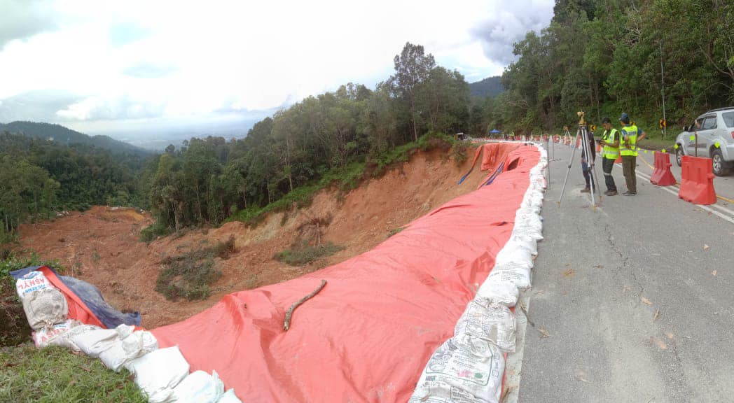
The slope in the area of the Batang Kali tragedy at the Father’s Organic Farm campsite was listed among the critical locations identified by the Malaysian Department of Minerals and Geosciences (JMG) back in September.
It is listed as critical due to the steepness at the risk level which is more than 45 degrees and the shape of the road embankment slope which has a high probability of landslides, reported Utusan Malaysia.
Speaking to Mingguan Malaysia, Deputy Director General of the Minerals & Geoscience Department (JMG), Zamri Ramli, said that his party had previously identified 254 slope locations at risk of landslides and the Farmer’s Organic Farm is among the list.
He said that slope steepness exceeding 25 degrees is categorized as high risk which requires detailed monitoring.
Enforcement still weak
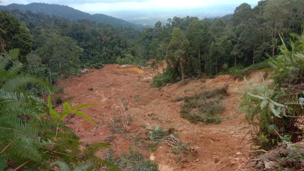
Pertubuhan Pelindung Khazanah Alam Malaysia (Peka) added that the landslide estimated at 500,000 metric tons with a height of 30 meters at Fathers’ Organic Farm on 16 December is evidence of the aspect of enforcement and monitoring of slopes in this country is still weak.
On the flip side, Zamfri shared that the Batang Kali slope was an embankment slope and that the continuous rain in the area before the tragedy made it weak.
“Based on the initial assessment, the soil saturation at the campsite is high due to the water content in the soil.
If you look at the area of the tragedy, it is flat land but there is a water channel in the ground that seems to be blocked,” he told Mingguan Malaysia.
“This is because based on the victim’s condition, it seemed like they were carried away by the current, other than the ground turning into mud. But we are currently identifying whether it is blocked because of the recreational campsite or because of the terrain itself,” he said.
Critical slope reported in Sep
Mingguan Malaysia also reported in September that 253 slopes across Malaysia were identified as ‘critical risk’ by JMG that threaten lives, especially in the monsoon season.
The factors for assessing the level of risk are based on the formation of steepness, the materials used, and the inappropriateness of land use.
He said that rainfall or surface or underground runoff, especially during the rainy season, can trigger landslides and slope failures.
He explained that the slope is also at high risk of collapsing if there are weaknesses in the design and deforestation or hill lifting.
Zamfri also reminded the members of the public who live in hilly areas or near slopes to be aware of the condition of the slope.
“If there is no water coming out in between the slope holes, it is actually worrying. It is possible that the water is blocked or the drainage system breaks until the water soaks into the ground until a landslide tragedy occurs,” he reportedly said.
Source: Utusan Malaysia
It’s unrelated to the article but here’s our brand-new podcast – Talk Je Lah!